Please enter your email and website or LinkedIn to receive more information about our free and paid accounts.
Please enter your email address below and we’ll send you instructions on how to change your password.
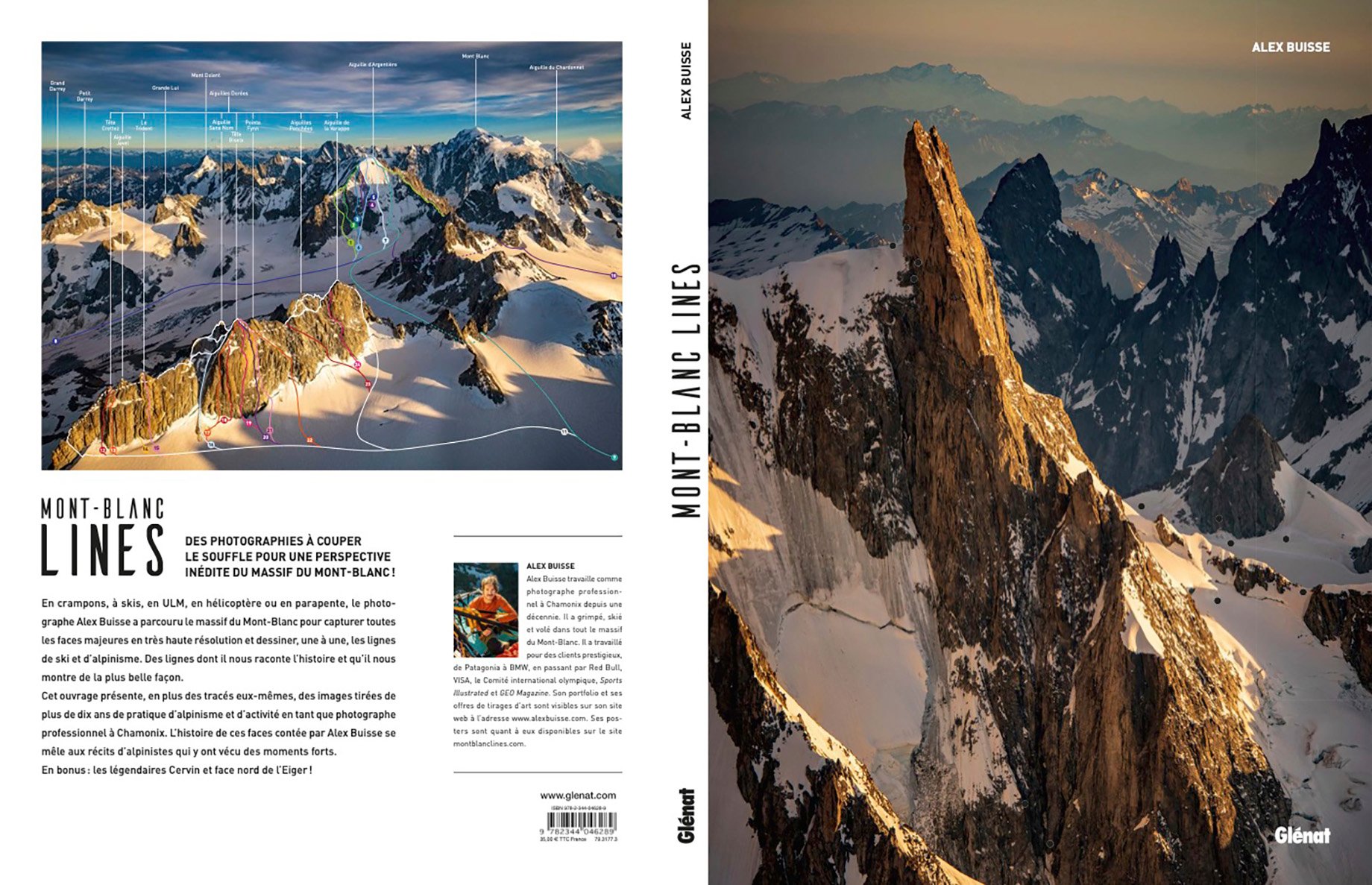
Alberta, Canada-based Alex Buisse combines aerial photography with a systematic documentation of climbing and skiing lines for his coffee table book Mont Blanc Lines. Mont Blanc Lines is a uniquely designed project that blends line drawings of climbing routes, a history of the Mont Blanc range, action photos, and excerpts from famous climbers in a beautifully published book.
In Spring 2020, COVID induced lockdowns brought Alex’s many projects (shooting sport climbing at the Tokyo Olympics and ski touring for Patagonia) to a screeching halt. When given the opportunity to partake in a sunset aerial landscape photoshoot from an ultralight plane, Alex quickly jumped at the chance to create fresh and exciting work. Despite the challenges he faced as a result of pandemic restrictions, his ingenuity and passion for photography paved the way for a new and exciting creative endeavor to be born.
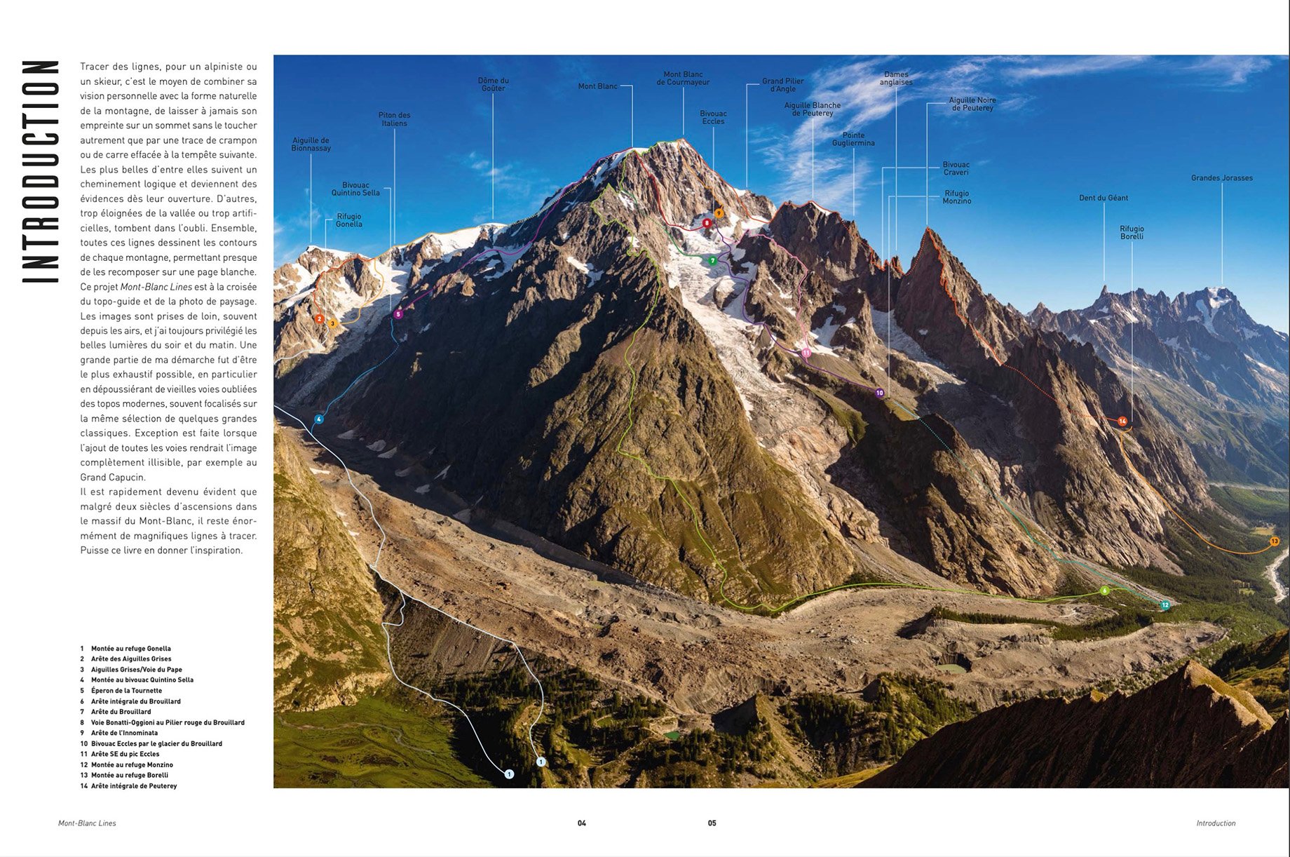
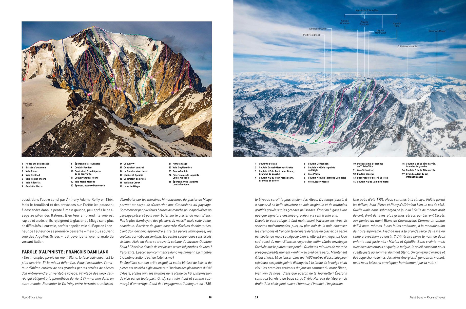
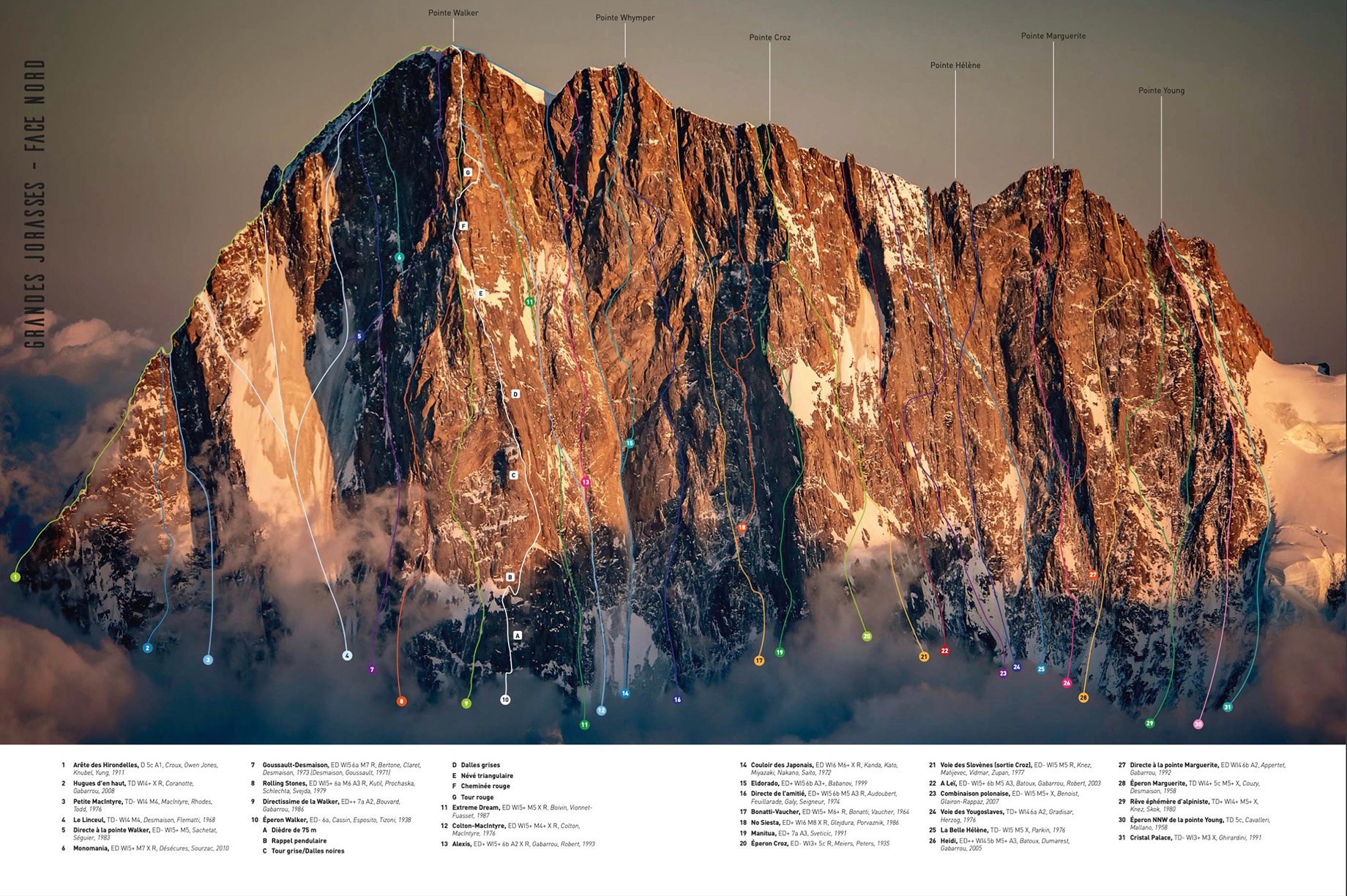
When I got home, I realized I had captured unique angles and beautiful light on famous mountains. I got my climbing guidebooks out and began drawing where each climbing route went.
After posting his photos on social media, the response to Alex’s images was overwhelmingly enthusiastic. He decided to embark on a fascinating personal project, a documentation of climbing and skiing lines all over the world. As an adventure enthusiast with an extensive resume of shooting at remarkable locations (including photographing Usain Bolt at the Olympics and skiing to the North Pole), Alex’s compilation transports readers to Mont Blanc, the highest mountain in the Alps.
With a summit of 15,777ft, Mont Blanc is located in the French Alps and more than 20,000 climbers reach the summit of the mountain each year. While the mountain can be pursued by climbers with varied skill levels and experience — provided they are accompanied by a certified mountain guide — there are considerable risks and precautions climbers would be wise to take into account. Regarded as the birthplace of modern mountaineering, the first men to ascend the mountain were Jacque Balmat and Michel Paccard in 1786.
Since Alex is far from having climbed every single route he draws, he’s forced to rely on external sources. Some of these sources, like François Damilano’s collection of guidebooks, are excellent but oftentimes information is very limited. Alex spends countless hours scouring old guidebooks, YouTube videos, and online trip reports to find all the facts available on any given route.
It’s a different kind of work than my usual photography, but something I find absolutely fascinating.
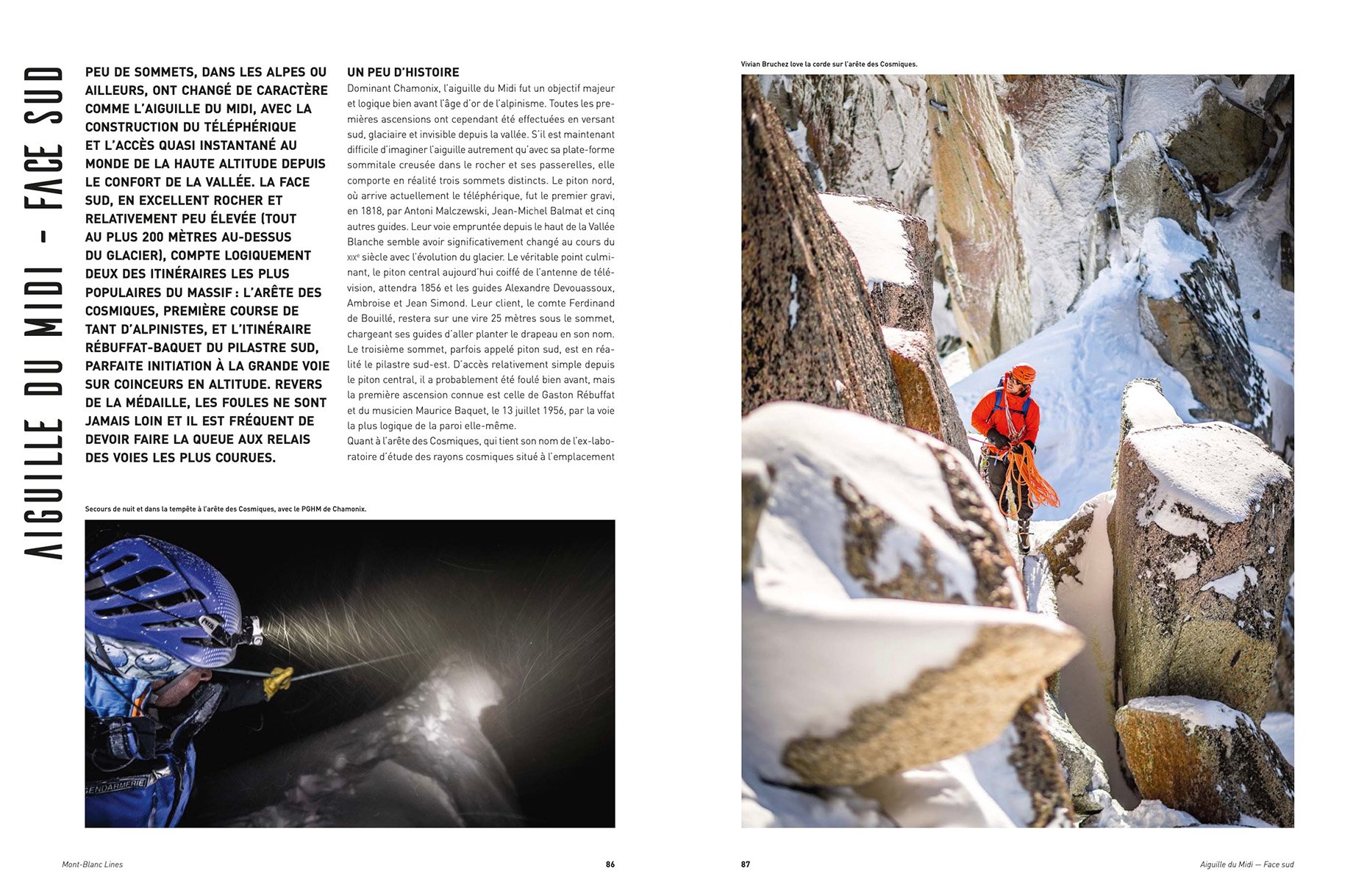
Although he now lives in the Canadian Rockies, Alex was based in Chamonix and the Mont Blanc range for over 10 years and knows the mountain very well. His first hand experience proved to be a big asset as readers trust him to know the conditions and suggest locations without needing extensive scouting.
Adventure and climbing have always been at the heart of my work, so it was a very natural fit.
This newfound project has sparked Alex’s creativity and provided him with an entirely new set of skills. He’s received great feedback from climbers and non-climbers alike. As well as the opportunity to get in touch with some of the first ascensionists of some of the lines in his book. Alex has spent most of 2021 expanding this project into the United States and plans to go even further afield: Canada, Mexico, the Andes, the Himalayas, and Australia are all places he would like to document in the future. Along with the book (that is currently available in Italian and will be published in English in early 2022) Alex also provides 55 free downloadable posters on his website.
I learned so much in so many different domains: improved my graphic design skills, learned a lot about the history of climbing in many different places, and also how to very precisely plan a sunrise or sunset shoot of a specific mountain face.
Credits
Photographer: Alex Buisse
Plane/Helicopter Pilot: Benoit Micolon
Publisher: Éditions Glénat